hu Norcenni Girasole village
Figline Valdarno - Via Norcenni 7
Book now

The Upper Valdarno is a broad natural basin, enclosed to the north-east by the Pratomagno massif and bounded to the south-west by the modest Chianti Mountains. The Arno enters through the “Valley of Hell”, a long gorge now occupied by two adjoining artificial reservoirs, and exits at the “Incisa Narrows”. The Valdarno valley is divided between the provinces of Arezzo and Florence. The Arezzo section widens to include the undulating territory crossed by the Ambra, a left-bank tributary of Tuscany’s greatest river.
The Upper Valdarno presents multiple landscapes: alpine and solitary on the high slopes of Pratomagno; marked by picturesque clay erosion phenomena at the foot of the same ridge; distinctly characterised by human activity in the central section, crossed by the country’s major transport routes (the Motorway of the Sun, the Rome-Florence direct railway line); typical Tuscan rolling hills to the south, towards the Valdambra and the Senese area.
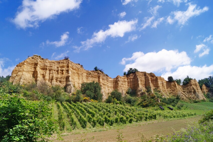
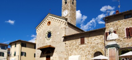
A singular and picturesque territory is that of the Arno Valley, starting from the point where, near Arezzo, the river reverses its course, directing it northwards. Emerged in prehistoric times as a lake that once flooded the basin until the end of the Tertiary era naturally drained away, it is an entire sequence of gentle slopes tormented by countless ridges eroded sheer by rainwater. Here everything is colour: the brown patches of pines at the top of the badlands, the dark oaks crouching at the bottom of ravines, the yellowish clay walls opened like incurable wounds, the eternal silver of olive groves and the green of vineyards that turn purple each year as the good season wanes. Throughout the valley, an hour’s walk apart, rise the bell towers of villages and towers of ancient settlements, parish churches and castles, some of which bear names with an Etruscan ring, such as Loro Ciuffenna, Gropina and Cennina.
For its wealth, the Valdarno was the object and theatre of bloody disputes between the two cities that, towards the end of the Middle Ages, aspired to dominance in Tuscany:
Guelph Florence and Ghibelline Arezzo.
At the end of the 13th century, to counter the military pressure they were forced to endure from the bellicose Arezzo bishops, who had powerful and heavily fortified castles in the Valdarno such as Cennina, Castiglione degli Ubertini and Laterina, the Florentines built three “walled towns”, namely three fortified villages: San Giovanni, Terranuova and Castelfranco.
After the death of Bishop Guido Tarlati in 1327, the Arezzo Republic underwent slow but inexorable decline, until in 1384 it ceased to exist and its territory was annexed to the Florentine Republic. With the disputes thus ended, the jurisdictional boundaries of the Arezzo district in the Valdarno were fixed along a line that also included the three walled towns built by the Florentines a century earlier.
Three roads from Arezzo lead to the Valdarno, following it for its entire length and reaching Florence:
the Motorway of the Sun, the SR 69 which follows the course of the Arno, and the Seven Bridges road, traced back to Etruscan times, which winds along the slopes of Pratomagno overlooking the valley from what is presumed to be the shoreline of the vanished lake.
While maintaining an agricultural tradition focused on the production of wines and olive oils of great renown, the Valdarno should be considered one of the areas of greatest and most ancient industrialisation in the Arezzo territory. The process of industrial development, concentrated in well-defined areas, has left intact the scenic charm and artistic heritage of the Valdarno territory.
To see all the facilities and book accommodation in Upper Valdarno use the form below, entering the dates of your stay.
City Card allow you to save on public transport and / or on the entrances to the main tourist attractions.
 Hotel
Hotel  Budget accommodations
  Apartments
  Family Hotel
  Luxury Hotel
  Resorts