Florence: Uffizi Timed Ticket & Masterpieces Audio App
7.148 reviews
Buy now
From 27,20€ per person
 Airport
 Village
 Citta
Citta Landscape
 Attraction
If you’re planning a trip to Florence, the interactive map on this page allows you to find all the attractions we recommend visiting, plus other useful points for your journey, such as the airport. Simply click on the markers on the map, or in the list below, to access detailed information about each point of interest.
Florence City Council has created a map of the city showing the main points of interest and transport links. Click the button below to enlarge, download it as a PDF, and print it.
Essential for any visitor, the Historic Centre map is invaluable for planning your itinerary to discover Florence’s finest attractions.
Florence tourist map in PDFFlorence is located in Tuscany, of which it is the regional capital, approximately 300 km south of Milan and around 100 km north of Rome. The city sits on the banks of the Arno, the river that flows through Tuscany from north to south. Florence is one of Italy’s most visited cities, renowned for its beauty and historical and artistic significance.
 Hotel
Hotel 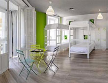 Budget accommodations
  Apartments
  Family Hotel
 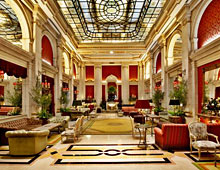 Luxury Hotel
  Resorts