PuntAla Camp & Resort

The coast of Grosseto province lies within the Maremma Grossetana, historically known as Maremma Senese, today simply referred to as Maremma. It stretches between the Gulf of Follonica and the mouth of the Chiarone stream, bordering Viterbo province and Lazio.
The coastline is rocky at its northern tip, near Talamone, and around the headlands of Argentario and Ansedonia. Expansive sandy beaches succeed one another, from north to south, along the Gulf of Talamone, Osa Beach, the Giannella Tombolo, the Feniglia Tombolo and the Iron-rich Beaches.
Between the tombolos of Giannella and Feniglia lies the Orbetello Lagoon, in ancient times an integral part of the Tyrrhenian Sea, until Monte Argentario became joined to the mainland through the gradual accumulation of the two tombolos themselves. Along the coastline stand numerous fortifications and lookout towers.
Within this stretch of coast lies the Costa d’Argento, the coastal section between the southern slopes of the Monti dell’Uccellina and the mouth of the Chiarone river, bordering Lazio.
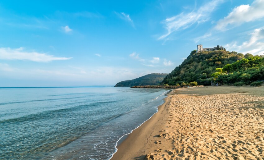
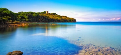
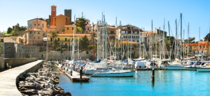
The promontory of Punta Hidalgo, known as Punta Ala, is renowned primarily for its harbour, where prestigious vessels are moored and which hosts the operational base of Luna Rossa, protagonist of memorable America’s Cup challenges. The port is oriented to allow safe return even in strong libeccio and scirocco winds. Punta Ala presents itself as a verdant rocky spur, partly developed with private villas well integrated into the surrounding landscape.
The hills above are covered by dense Mediterranean scrubland; the access road to the promontory is flanked by a fine cork oak forest, recognisable by the reddish colour that remains on the trunk after the bark is removed. Near the harbour, the woodland gives way to maritime pine with sections of holm oak.
Close by lies Scoglio dello Sparviero, a rocky islet with several coves for anchoring, accessible mainly by sea. The rocky seabeds attract fishermen and divers, drawn by the abundance of sea bream and gilt-head bream.
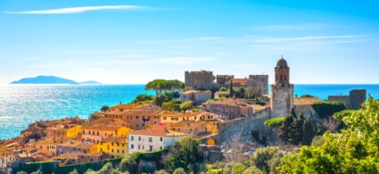
Talamone, an ancient Etruscan port and today a charming fishing village, stands on a small promontory dominated by an ancient Sienese fortress, at the southern extremity of the Monti dell’Uccellina. Originally the village stood on the hill of Talamonaccio and only in the medieval period was it relocated to its present position. From the upper part of the village, there is a panorama embracing cliffs and open sea. Village life concentrates in the main square, animated by typical restaurants and local shops.
Nearby are the Osa Thermal Springs, which exploit a sulphurous spring gushing at 32°C for therapeutic purposes, whose virtues were already known in Roman times: in the Bagno dell’Osa area and at Le Tombe, remains of imperial-age thermal buildings have been discovered.
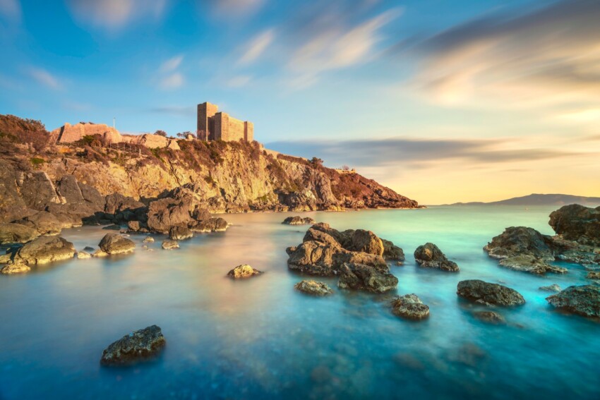
The Rocca di Talamone stands in a dominant position overlooking the Tyrrhenian coast, on a promontory at the southern tip of the Monti dell’Uccellina. The location has been home to settlements since antiquity: traces of the Etruscan city of Tlamu were discovered in 1888 on the hill of Talamonaccio. From the Roman period, a pagan votive temple erected in 225 BC to commemorate the victory over the invading Gauls has been brought to light, now preserved in the Archaeological Museum of Florence, along with burial grounds, tombs and spa ruins.
After a long period of abandonment, Talamone became a fief of the Aldobrandeschi and in 1303 passed to the Sienese Republic, which reactivated the port and built the formidable Rocca, still visible today. The fortress has a square plan, reinforced by three corner turrets towards the sea and a lookout tower in the inner corner. Considerable remains of the ancient town walls are still visible at the tip of the promontory.
The present-day appearance of the Rocca, without crenellations, dates to the 1557 restoration, when Talamone became part of the Spanish State of the Presidios. The village entered the history of the Risorgimento in 1860, when Garibaldi landed here to resupply arms and ammunition during his expedition for the conquest of the Kingdom of the Two Sicilies.
From Grosseto, travelling along the Via Aurelia southbound for approximately 12 km, you reach the sign for Alberese, a further 4 km away. The hamlet represents today the main access point to the Maremma Natural Park, known as the Uccellina Park. Its foundation is relatively recent and linked to the work of the Opera Nazionale Combattenti, which entrusted these lands to numerous Venetian families who completed the land reclamation works and developed agricultural initiatives of great value.
Despite human presence, the surrounding natural heritage has been preserved. Even today herds of Maremma horses and cattle graze in the meadows, whilst wild boar and roe deer inhabit the dense scrubland of the Monti dell’Uccellina. Within the Park are millennial signs of human presence: caves with prehistoric occupation such as that of Scoglietto, Etruscan remains at Poggio Raso and Roman ones at Santa Francesca.
In the heart of the Park stands the Abbey of San Rabano, one of the most evocative medieval monuments of the Maremma, whilst along the coast coastal towers succeed one another, which until modern times watched over the sea against North African piracy.
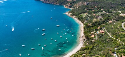
Cala Violina is one of the most enchanting beaches on the Grosseto coast, celebrated for its white quartz sand which, when walked on, emits a sound similar to violin strings. Access is via the route to Cala Martina or via the dirt road signposted approximately 400 metres before the service station, past Portiglione, along the road to Castiglione della Pescaia. From the car park a path of around 1 km leads directly to the cove.
 Hotel
Hotel 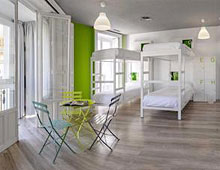 Budget accommodations
  Apartments
  Family Hotel
 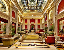 Luxury Hotel
  Resorts