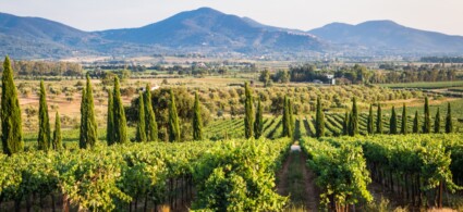
Vallicella Glamping Resort
Scarlino - Località Vallicella
Book now

Situated on the northern ridge descending from Monte d’Alma at an altitude of 250 metres, it currently has around 600 inhabitants. There are various entry points, but we recommend parking at the castle square and beginning your walk from here, following a less demanding route in terms of both time and effort.
First, visit the fortress and the adjoining archaeological park, where you can see the remains of foundation walls from Hellenistic-era constructions (4th–2nd centuries BC), as well as the Pisan fortress itself from the 13th century. In the archaeological park, walls of dwellings contemporary with the fortress are visible, and further down are the remains of two apses, one adjacent to the other: the more prominent one dates to the 12th century, whilst the lower and less visible one dates to the 10th century. During the most recent excavation campaign (1983), a glazed terracotta jar containing 100 gold florins struck by seven mints, including one foreign one, was discovered in the remains of the more recent church. These coins can be dated to the first half of the 14th century. They are currently on display at the Territory Documentation Centre, where they can be admired alongside restored and catalogued Spanish ceramics (13th century) from the University of Siena.
Leaving the archaeological park and descending a short slope, you’ll find yourself at the Piazza della Stella, which offers stunning panoramic views. To the left is the Novelli house (a private residence with some frescoes by the Sienese school from the mid-15th century on an upper-floor wall); to the right, a winding staircase leads down to the Territory Documentation Centre. Just a few metres away on the right is the Church of San Martino, whose bell bears the date 1340. The church underwent its first restoration in the second half of the 1700s at the behest of Eleonora Appiani, then again during the Fascist era and finally in the late 1960s. An interesting fact: in 1919 the church was occupied for a week by a group of anarchists. Leaving the church and descending a few steps, you’ll see the Town Hall on your left, dating back to the 13th century, with two other buildings from the same period opposite and to the side.
Descending beyond these two buildings takes you to Piazza Garibaldi, whose monument, inaugurated on 2 September 1900, occupies the centre of the square. From the square, you can pursue three routes: descending the steps to the right, you exit through the Senese Gate (1255); after about 200 metres on the right you’ll see what remains of the Madonna degli Angeli; a further 300 metres ahead (at the fork, descend to the left) you’ll arrive at a small square where the Canalino spring is located. The Madonna degli Angeli was built in the late medieval period as a hospice to shelter travellers and the needy. Restored in 1597 by Isabella Mendoza, widow of Alessandro Appiani, it was handed over to the Augustinian friars of San Donato. By 1822 it was already in a state of decay and abandonment. The Canalino spring was built in the second half of the 1500s to collect waters from the northern slope of Monte d’Alma. It was equipped with a watering trough for pack animals in 1779. It was used as a public wash house and spring until the 1960s. It has been recently restored. Returning to Piazza Garibaldi, descend the steps beside the Count’s palace (Curia Comitis), on whose wall a plaque commemorating Caterina Appiani is affixed. You’ll arrive at a small square offering further steps to descend: you’ll find yourself in another small plaza, at the left side of which opens the Gate to the Sea or Pisan Gate, built in 1326. Sections of the old walls are still visible (as with the Senese Gate), and dwellings have stood upon them for a long time.
Via Giterni connects Piazza Garibaldi with the Church of San Donato. This church dates to the 12th century. It is characterised by a Latin cross layout and a single central nave. Within it converge two architectural styles: Gothic and Romanesque. It was restored in 1757, 1929 and, only the roof in the 1960s. It houses various works of sacred art, including liturgical objects and instruments. Adjacent to the church, on the side opposite the entrance on Via Citerni, stands the old Augustinian Convent, a characteristic medieval building whose origins are uncertain: it is known that in the 11th century the Hermits of Saint Augustine took up residence here. From 1652 to 1672 it underwent initial restoration work. A restructuring project has long been under study.
The remains of the Canonica at the foot of the town on the Puntone side, dedicated to San Michele, in Pisan-Romanesque style (13th century);
The remains of a Roman villa at Puntone Vecchio;
The Val Molina excavations, which uncovered a significant Etruscan settlement;
The convent of Monte di Muro. This convent is located at 344 metres above sea level and can be reached via the provincial road that runs from Puntone to Scarlino. It is associated with the reputation of Blessed Tomma (Tommaso Bellacci), who took up residence here in the first half of the 15th century. It was plundered by Turkish raiders in 1534 and 1539. It was closed in 1806 following Napoleonic legislation.
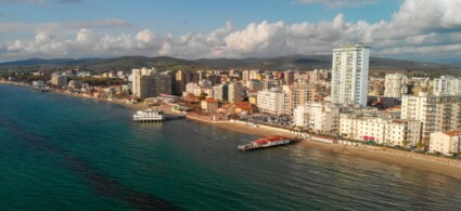
The significance of the town of Scarlino and its castle is inherent in the etymology of its name: although some believe it derives from the Roman port called Porto Scabris once situated on the nearby coast, the theory linking it to the Lombard term Scherl, meaning lookout point, seems more probable. Indeed, thanks to its extraordinary position, from which the entire underlying plain and a large stretch of coastline from Piombino to Punta Ala can be observed, the castle historically served repeatedly the purpose of spotting and communicating the arrival of enemies to inland towns.
The establishment of the town and the construction of the fortification in an elevated and difficult-to-reach position, rather than in the nearby lowland plain more favourable for commerce and communications, was essentially due to the fact that, in the years immediately following the collapse of the Roman Empire and coinciding with the first invasions of northern populations, the plain itself had become an immense and unhealthy marsh owing to the combined action of marine currents and debris from the Pecora river.
The South-West tower, a spur jutting out from the walls.
The earliest records of a fortified settlement at Scarlino date back to 973, though it is impossible to determine what it looked like at that time. Later, ownership of the castle passed to the Conti Alberti of Prato and Mangona, and in 1164 it was conquered by the Pisans, who had always been interested in controlling the area for commercial purposes. Subsequently, around 1240, Scarlino was one of the first towns in the Maremma to organise itself as a free commune. In 1399 the town became part of the principality of Piombino and remained so until 1814.
The castle’s present appearance, dating to the 12th century, is due to the noble Aldobrandeschi family of Sovana, who acquired Scarlino through the marriage of Ildebrandino Aldobrandeschi to a daughter of Count Alberto Alberti. Subsequently, the Pisans, to assert their political and military dominance in the coastal area, promoted its restructuring, which is why the castle is today known as the Rocca Pisana (Pisan Fortress).
The fortress has an irregular five-sided plan and is connected to the city walls, which still join it today at the North-West corner of the outer enclosure [at one time the South-West vertex was also connected to the walls]. Substantial stretches of the fortified city enclosure remain, together with the Senese Gate and two powerful round towers positioned at the highest part, which together with the fortress itself crown the hilltop.
External defences are present only on the two sides of the castle most easily accessible from the town—North and North-East—and were equipped with crenellations and protected by a moat hewn into the rock. On these two sides the core of the fortification was not defended by towers, but remains of corbels survive as evidence that the walls were equipped with projecting defensive apparatus, at least at the North-East corner. The remaining three seaward-facing sides are equipped with taller curtain walls and defended at every angle by a tower: the South-East one is square and taller (being the only one with its front directly facing the sea, it served as a lookout tower) and the South-West one arranged as a spur to maximise the possibility of flanking fire from the loopholes.
The North-West tower, certainly of later origin than the rest of the castle, is instead round and preserves remains of corbels upon which the defensive apparatus for plunging fire rested. Internally the only surviving structure consists of a cistern for rainwater collection, located in the north-eastern area, since in the last century the interior perimeter was converted into a cemetery area. Recent restorations have made the structure available for shows and events.
To see all the facilities and book accommodation in Scarlino use the form below, entering the dates of your stay.
 Hotel
Hotel  Budget accommodations
  Apartments
  Family Hotel
  Luxury Hotel
  Resorts