Agriturismo Borgo Biaia
Camporgiano - Località Biaia 1/a
Book now

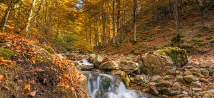
Camporgiano sits in the upper Serchio valley in Garfagnana, on the right orographic bank of the Serchio river at 475 metres above sea level, in a valley that separates the two mountain ranges of the Apuan Alps and the Apennines. The municipality of Camporgiano covers an area of 27 square kilometres and encompasses the hamlets of Filicaia, Sillicano, Poggio, Roccalberti, Casatico, Vitoio, Puglianella, Casciana and Cascianella. The landscape that presents itself to visitors is that of the upper hills: dense chestnut woods, arable fields and extensive meadows.
The cultivation of spelt is widespread (in Casciana, Casatico, Roccalberti and Sillicano). A defining characteristic of the rural landscape is the terraces painstakingly constructed by locals to make the slopes cultivable.
The settlement is fragmented into small hilltop clusters – most of the hamlets fall into this category – and larger settlements in the valley floor (Camporgiano, Filicaia). The villages have nonetheless retained their medieval urban layout, and each bears important evidence of Garfagnana’s culture and history. Consider the small village of Roccalberti, the churches of San Biagio in Poggio, Santa Maria Assunta in Vitoio, S. M. Assunta in Puglianella, San Nicola in Sillicano, San Tommaso in Casciana, and the numerous rural shrines encountered whilst exploring the territory. As for aspects of daily life, the chestnut-roasting houses serve as reminders to visitors that the chestnut was an essential commodity for the local population for centuries.
The history of this territory is documented by archaeological evidence dating from the 7th century BC, which demonstrates the presence of a Ligurian-Apuan population. In the 2nd century BC, the Romans penetrated these lands and established settlements, traces of which survive in place names today.
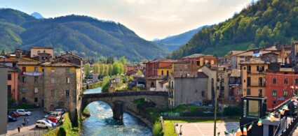
As its Latin-derived name suggests, Camporgiano was founded during the period of Roman colonisation, a hypothesis supported by the discovery of coins. During Roman rule, the territory of present-day Camporgiano held considerable strategic, commercial and cultural importance, as it lay along the via Clodia, the main road connecting Lucca to Luni. Camporgiano‘s significance in the medieval period is evidenced by the fact that it possessed a fortified nucleus and was the seat of a Vicaria – an administrative jurisdiction established in 1272 – which had authority over 55 communities.
In the 14th century, the Vicaria was contested between Guelphs and Ghibellines, and in 1345 it fell under Pisan rule, remaining so until 1371, when it returned to Lucchese territory. Another period of uncertainty and instability followed the Florentine invasion of Lucca in 1430. However, a desire was growing among local communities to join the Este lordship – an emerging power capable of defending Garfagnana from the claims of other states. Almost all Garfagnana territories pledged their allegiance to the Estes, who accepted. Camporgiano remained a Vicaria of the House of Este until Italian unification. A decree of 23 October 1859 assigned Camporgiano to the province of Massa Carrara. In 1923, a new royal decree established what remains the current administrative status of the territory, with Garfagnana assigned to the province of Lucca.
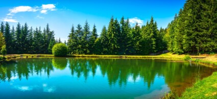
Camporgiano and its hamlets present themselves as one of the most interesting areas of Garfagnana for those seeking to connect with the nature, history and traditions of this land. Even today, a defining feature of Camporgiano is the Este fortress, which from its elevated position dominates the main town square. At its base stands a stone fountain traditionally known as the pilon. The fortress, built on a rocky outcrop, was probably constructed in the 10th century for defensive purposes and was later enlarged in the 12th or 13th century. The main tower is characterised by projecting cornices of sandstone, which once supported overhanging wooden hoardings. The fortress’s current configuration exemplifies 15th-century Este military architecture. The 1920 earthquake that devastated this region destroyed the low cylindrical towers that crowned the corner towers. In the chapel of the San Giacomo parish church, you can admire a fine 14th-century panel painting of the Sienese school depicting S. Maria delle Grazie.
The territory of Camporgiano municipality also allows you to experience close contact with nature and spend days immersed in greenery. The nursery tradition is preserved by the publicly-owned forestry nursery La Piana, established in the late 1950s by the State Forestry Corps and managed since 1999 by the Garfagnana Mountain Community. La Piana nursery cultivates seedlings for reforestation, but today it also serves as a centre for experimentation and promotion of organic and biodynamic forestry and agricultural techniques for typical crops and native forest varieties (medicinal plants, broom, willow, dogwood, etc.). La Piana nursery can be visited by schools and universities for educational purposes and by sector professionals. For information, contact the Garfagnana Mountain Community. For fishing enthusiasts, on the banks of the Serchio river stands the “Il Prato” complex, which features a lake for sport fishing, plus a bar, restaurant, pizzeria, camping facilities and a swimming pool.
To see all the facilities and book accommodation in Camporgiano use the form below, entering the dates of your stay.
 Hotel
Hotel  Budget accommodations
  Apartments
  Family Hotel
 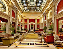 Luxury Hotel
 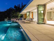 Resorts