 Airport
 Island
Florence: Uffizi Timed Ticket & Masterpieces Audio App
7.148 reviews
Buy now
From 27,20€ per person
 Attraction
 Citta
Citta Landscape
 Village
If you’re planning a trip to Tuscany, the interactive map on this page will help you find all the attractions we recommend visiting, plus other useful points for your journey, such as airports and islands. Simply click on the markers on the map, or in the list just below, to access detailed information about each point of interest.
Tuscany is a region located in the centre-west of the Italian peninsula. It’s one of the largest regions in central Italy and one of the most densely populated; though it’s worth noting that population density varies considerably depending on the area.
The Tuscan landscape is predominantly hilly; approximately 25% is occupied by the mountain ranges of the Apennines, the Apuan Alps and other mountain groups, whilst less than 10% is flat.
The highest peak in the region is Monte Prado, at 2,054 metres. The few plains extend along the coastal strip and inland in the northern part of the region. The coastline is extremely varied, featuring both long sandy beaches and extensive stretches of rocky, jagged coast.
Tuscany borders Lazio to the south, Umbria, Emilia-Romagna and the Marche (for a very short stretch) to the east, and Emilia-Romagna and Liguria to the north. To the west it is washed by the Ligurian Sea in the north and the Tyrrhenian Sea in the centre-south.
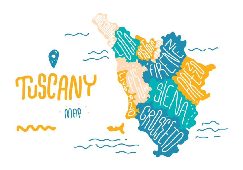
From an administrative standpoint, Tuscany comprises 10 provinces. From north to south, these are Massa and Carrara, Lucca, Pistoia, Prato, Florence, Pisa, Livorno, Arezzo, Siena and Grosseto; since 2015 the province of Florence has become a Metropolitan City.
The islands of the Tuscan Archipelago are also administered by the region.
 Hotel
Hotel  Budget accommodations
  Apartments
  Family Hotel
  Luxury Hotel
  Resorts