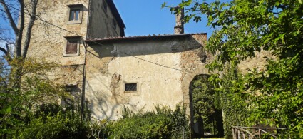
Agriturismo Selvapiana
Cantagallo - Via Selvapiana 5
Book now

In the upper Bisenzio valley, within an Alpine setting of considerable appeal to visitors, the Municipality of Cantagallo stretches across a series of transverse buttresses of the Apennine chain.
The layering of place names bears witness to the ancient settlement of the territory: beyond Usella, a toponym which various scholars propose derives from Etruscan, numerous locations have retained names featuring characteristic Roman-era land-tenure endings (Luicciana, Migliana, Campagnana, Gricigliana, Sezzana, Bucignano, etc.). This phenomenon points us back to the territorial organisation of the past, when the valley bed of the Bisenzio saw a kind of natural link between the Prato basin and the Po Valley. In the Middle Ages, indeed, one of the principal roads to Bologna still passed through Filettole and Usella, following the Bisenzio valley up to the Montepiano pass. The earliest written records (13th century) speak of a dispute between the monks of the Vallombrosan Abbey of Vaiano and the representatives of the rural Municipality of Cantagallo.
Until the 14th century, the territory of the present-day municipality was subdivided on several occasions, but for most of those years the Counts Alberti of Prato exercised control through their own vassals, later selling some castles to the municipality of Pistoia. In 1400, with the union to Luicciana, the podesteria was recognised, which, besides the current territory, also included the settlements of Torri and Treppio. Subsequently, the aforementioned podesteria was united to that of Montale, initially maintaining the subdivision into rural municipalities, thus remaining a border zone with the Vernio feud.
Luicciana (423 m), the main town and administrative seat of the Municipality of Cantagallo, enjoyed considerable development in the 17th and 18th centuries, when an important market was held there. The ancient settlement was completely destroyed by German troops in 1944; the current development, of recent appearance, was revitalised between 1981 and 1984 with the creation of the Open-Air Museum of Contemporary Art, comprising a rich collection of works executed with a wide variety of techniques on the facades and courtyards of houses and the Town Hall, itself rebuilt in the post-war period. Well-known painters and sculptors from Prato participated in the initiative with works ranging from figurative to abstract and transavantgarde (among them Rinaldo Frank Burattin, Leonetto Tintori, Salvatore Cipolla) and from Tuscany (Vinicio Berti, Gualtiero Nativi, Silvio Loffredo), alongside artists of international renown (Sebastian Matta, Toni Fertonani).
A steep road climbs to the Church of San Michele, on the summit of the small hill. Documented from the 13th century, it was substantially transformed in the early 18th century and around 1760. Inside, featuring refined and unified 18th-century decoration, there is a contemporary statue of the Madonna and Child; the altarpiece of the high altar, with San Michele (1938), is a copy by Guido Reni.
West of Luicciana, on the Poggio di Terrabianca, you reach Trebbio, then Castello (559 m), with a medieval settlement perched on the road that winds up to the ancient Castello Averardi, documented in 1110 and sold by the Alberti to the people of Pistoia in 1336. Only the Romanesque church of Santa Maria remains, from which there is a suggestive panorama. Preceded by a portico, it preserves sandstone walls on the sides and small apse. Inside, the large high altar (1774) has a modest panel with Four Saints framing a venerated Madonna and Child, a canvas from the early 1700s.
Below the provincial road to Cantagallo stands the Mulino del Rosso (property of the community of Cantagallo in the 1300s, later of the Bardi family), one of the few still in operation, with an 18th-century chapel and medieval turret.
Shortly after, a junction leads to Cantagallo (572 m), almost completely destroyed in 1944. Of the ancient nucleus, only the Church of San Biagio remains (second half of the 12th century), which was under the patronage of the Abbey of Vaiano.
Medieval masonry surfaces on the modest facade, which unifies the church and the oratory of Madonna della Neve. On the high altar stands a wooden crucifix from the 18th century and on another altar a fine Madonna and Child with four Saints (early 1600s). From the same period, in the oratory, there is a small canvas with the Madonna, Child, Saints and donors.
Around the SS 325, the part of the municipality of Cantagallo that separates Vernio from Vaiano develops. Beyond Fabbro, the Bisenzio valley opens up, softening its slope; here stands Villa Guicciardini, within a beautiful tree-lined park, which was the centre of a vast estate of the Bardi, later of the Guicciardini (1810), who substantially restructured it around 1860.
The spacious neo-18th-century façade, punctuated by rusticated pilasters, has a horizontal cornice with a central gable; various rooms, the grand staircase and the chapel retain 18th and 19th-century decorations. Along the northern elevation are the farm buildings and stables, of neoclassical appearance.
Beside the villa, a road rises up the small valley of the Migliana stream and, passing the Castiglioncello complex (where the Longobard fortification of Castiglion Merlini was built, destroyed in 1320-30) and the 16th-century Tognetti house, reaches Migliana (603 m). A pleasant summer resort, Migliana overlooks a vast stretch of the Bisenzio Valley from a ridge rich in vegetation, especially well-maintained chestnut woods, which for centuries constituted the basis of the local economy.
The Church of Santa Maria Assunta, in local stone (completed in 1946, designed by A. Colzi), has a Latin cross plan with polygonal apse. It preserves a Renaissance ciborium, whilst the apse is frescoed with the Assumption and Saints, a work by Silvestro Pistolesi. Behind the church stands the ancient parish church, from the 12th century, with a small facade topped by a bellcote. Near the church, the panoramic Path of the Tabernacles rises among the chestnut woods, passing various Marian tabernacles (many from the 18th and 19th centuries).
From the village of Cantagallo, a path leads to the Treppio Pass (996 m); from here you reach Pian della Rasa, tree-covered and rich in water sources, with the Luigi Pacini refuge (1001 m), built in 1931-36 and recently refurbished, a traditional destination for excursions on the Prato Apennines. Returning to the provincial road from Luicciana (at the confluence of the Bacuccio stream with the Bisenzio stands the ancient Sega mill, converted into a small dwelling), you reach Luogomano (635 m), a medieval settlement destroyed in 1944, and from here the Acquiputoli Pass (987 m) and Cascina di Spedaletto (881 m), where the Hospital of Saints Bartholomew and Antolino was founded in the 12th century, later transformed into a rural building, within a meadow surrounded by ancient beech trees. Adjacent is the 18th-century oratory of Saint Anna.
Near Luicciana, from the road to Mercatale, a ridge path rises into a beautiful area of woodland and pasture. Below the road, along the Carigiola stream (boundary between the municipalities of Cantagallo and Vernio), where ancient chestnut mills remain, are the hamlets of Sanguineta (476 m) and Peraldaccio (445 m).
The ridge path, leaving to the right the Rotì complex (834 m), where a very ancient Bardi Hospital stands, transformed into a farm by the Guicciardini (owners since 1882), passes near the settlement of Gavigno (764 m), once part of the County of Vernio, with the oratory of Saint Augustine (1032), featuring graceful neo-medieval forms. The scenic road continues to climb Poggio la Zucca (1139 m) until it crests at the Gavigno tabernacle (968 m), a chapel-shelter of 17th-century origin, and reaches Fossato (747 m), among the most interesting locations in the Prato mountains for the structure of its settlement and the possibility of excursions.
An ancient possession of Matilda of Tuscany, it was taken by Pistoia but reclaimed by Pope Honorius III, who granted it in fief to the Alberti. This family managed to obtain it only from 1287 to 1319; it then returned to Pistoia to pass into Florentine territory in 1401. An important border location between the Grand Duchy, the Papal States and the County of Vernio, thanks to pastoralism and agriculture, Fossato experienced considerable development until the 19th century, when it began a gradual, massive emigration towards Corsica and France.
At the end of the settlement stands the Church of San Lorenzo, along the road to Torri, built in the 11th century and enlarged around 1580 with side aisles. The sturdy bell tower is perhaps from the 13th or 14th century. Inside, the three aisles are supported by squat Tuscan columns (around 1580); on the high altar (1669) is a venerated wooden crucifix from the early 1700s, and from that century also date the choir stalls of the two chapels and an original painted majolica Way of the Cross.
From the church, you descend into the picturesque main settlement, with buildings in sandstone, rich in recesses, covered passages, small staircases and 18th and 19th-century openings. The oratory of San Rocco (1710-11, with a small loggia from 1797) also preserves an 18th-century majolica Way of the Cross, as well as wooden statues from the 18th and 19th centuries; on the beautiful high altar (1723) is a contemporary canvas with the Madonna, Child and Saints. In the northern area, a sturdy complex incorporates a tower, possibly a remnant of the 12th-century Castle.
Continuing towards Treppio, you reach the road that rises along the lower Limentra course to L’Acqua (591 m), with 18th and 19th-century buildings and the Church of San Donato. The beautiful panoramic road touches, in the municipality of Sambuca Pistoiese, Monachino (697 m) and L’Acquerino (891 m), at the centre of the state forest, where there is a well-known refuge.
On the SS 325, after crossing the boundary with Vaiano and the hamlet of Il Fabbro, you encounter Usella (177 m); arising in the medieval period around the parish church, it was ceded by the Alberti in the 1300s to Florence.
The parish Church of San Lorenzo, one of the oldest in the valley (documented in 997), was from 1189 under the patronage of the Abbey of Vaiano and underwent transformations and rebuilding, until the radical restructuring of 1907 (G. Bacci), which enlarged the church by creating two side aisles from the convent and rectory.
The modest classical forms of the facade and interiors are due to this intervention, though the barrel vaults on the central nave date to the 18th century. The altars on the right preserve interesting canvases: a Madonna of the Rosary from the early 1700s and a Madonna and Child with Saints attributable to Empoli (1554-1640); on the high altar is a respectable crucifix from the early 1700s.
The baptismal font has an elegant late Mannerist basin in white marble. From the parish church, a road climbs the Sieve stream and, crossing terraced meadows with vines and olives, reaches the 13th-century small church of Santo a Codilupo (San Michele), with sandstone walls and apse; next to this, a junction leads to the right to the Tower of Codilupo, a turreted complex arising on the remains of a medieval fortification.
Returning to the state road, beyond Usella you arrive at the settlement of Colle; from here a road climbs to Cambiaticcio, a fine complex with a tower house, before which a small path on the left leads to Villa Antella, of 16th-century appearance (with 19th-century transformations) and, on the summit of the ridge, to the remains of Montauto Castle (in the 12th century it belonged to the Ubaldini, then the Pipini, finally the Alberti, who sold it to Florence in 1382).
From Colle another path rises along the Fornelli stream to Mezzana (445 m), a deserted village with interesting medieval structures.
Returning to the state road and passing the ruins of the 15th-century Sessato bridge, destroyed in 1944, you cross Carmignanello, of recent development; on the left a road climbs to Gricigliana (353 m), a small settlement gathered around the oratory of Santa Caterina (parish church from the 13th century, restructured in the 1700s) and the overlying Villa Novellucci, arising on the remains of a medieval fortified building. The villa was long owned by the Novellucci, then from the 1800s by the Guicciardini, and retains a robust, severe 17th-century character, with a tall double-flight staircase leading to the arched portal.
The same taste and severity characterise Villa Edelmann, formerly of the Novellucci, along the SS 325, nestled against a rocky spur (hence the notable vertical development and modest depth). It also has at its centre an arched portal accessible by an elegant multi-flight staircase; the interiors preserve older structures, with vaulted rooms or coffered wooden ceilings.
Just before the villa is a small road that crosses the Bisenzio over a fine three-arch stone bridge, from 1343, beyond which a path climbs to the Rocca di Cerbaia (368 m), dominating from an overhanging spur the valley. Built or restructured by the Alberti in the early 12th century, it was sold to Florence in 1361. The fortified complex, in local sandstone, preserves traces of two curtain walls; the upper one has at its centre the imposing ruin of the pentagonal Keep, perhaps from the second half of the 13th century.
Returning to the Bisenzio, just north of the bridge is the Pispola mill, which harboured Garibaldi in flight from Romagna on 25 August 1849; nearby, the Romei textile mill was established in 1860; continuing along the state road, at Dogana (222 m) stands the robust 18th-century building that once stood near the boundary with the County of Vernio.
The Acquerino-Cantagallo Nature Reserve covers an area of 1,726.06 hectares, stretching across the municipalities of Cantagallo and Montemurlo in Prato province and Sambuca Pistoiese in Pistoia province. The reserve, comprising a single continuous body, is bounded to the west by the surroundings of Acquerino and the Limentra di Treppio stream, running north-westerly along approximately the watershed of Poggio al Sasso, Poggio Acuto and Le Cavallaie. Its southern point is marked by Javello farm, whilst the eastern boundary follows the ridge of Monte Javello.
The reserve encompasses an Apennine zone situated between 450 metres and 1,204 metres above sea level.
The dominant species are sweet chestnut and turkey oak. Along watercourses, crack willow, black alder and hazelnut are common (the latter also found in particularly cool areas alongside hornbeam). The tall-herb understory is characteristic of deep soils, whilst areas of intermediate fertility feature indicator species such as bramble and fern, gradually transitioning to more degraded zones where charcoal-makers’ broom is typical.
Beech-dominated woodlands occupy the highest areas, reaching the summits of the mountain peaks. Within the forest, you can admire the “Faggione di Luogomano” (an ancient beech tree).
The Acquerino-Luogomano Reserve boasts a particularly rich faunal heritage, especially regarding valuable ungulates such as red deer and roe deer (wild boar, reintroduced in the mid-1950s, is becoming an invasive species).
The predators are typical of the Apennines: fox, stone marten, weasel and, to a lesser extent, European polecat. However, particularly noteworthy is the reappearance of protected and important species such as the wolf and wildcat (which have disappeared permanently from many other Italian forests). Among raptors, buzzards and kestrels are common, as are peregrine falcons, eurasian hobbies and red-footed falcons during migration periods.
The reserve’s accessibility and good road links to nearby towns have fostered a steady flow of visitors, particularly at weekends. An important activity in terms of overall forest footfall is the harvesting of forest-floor produce. The harvest, regulated by current legislation, focuses on secondary woodland products such as wild mushrooms, bilberries, strawberries, blackberries and juniper berries.
From Santa Lucia, take the SS325 road as far as Mercatale di Vernio. Near Caffè Nuovo, turn left following signs for Cantagallo. After passing Luicciana, continue along the road on your left towards Mulino della Sega – you’re now inside the Acquerino-Cantagallo Nature Reserve.
What's the weather at Cantagallo? Below are the temperatures and the weather forecast at Cantagallo for the next few days.
To see all the facilities and book accommodation in Cantagallo use the form below, entering the dates of your stay.
 Hotel
Hotel  Budget accommodations
  Apartments
  Family Hotel
  Luxury Hotel
  Resorts